
 LiDAR(Light Detection and Ranging) is an advanced surveying and mapping technology that utilizes laser pulses to generate high-precision three-dimensional (3D) data. It enables rapid, reliable, and detailed modeling of terrain, structures, and infrastructure.
Advantages of LiDAR Scanning:
High Accuracy and Precision: Delivers exceptional geospatial reliability and technical rigor.
Efficiency in Large-Scale Surveys: Rapid data acquisition over extensive geographical areas in minimal time.
Reliable Measurements: Robust data capture even in high-topographic complexity or hard-to-reach zones.
Vegetation Penetration: Capability to penetrate dense canopy cover to map the underlying bare earth.
Point Cloud Generation: Creation of high-density point clouds and complex Digital Terrain Models (DTMs).
Primary Applications:
Construction and infrastructure projects.
Urban planning and 3D modeling.
Topographic and geodetic surveying.
Renewable energy projects (solar and wind power plants).
As-built documentation and architectural restoration.
Monitoring of highways, tunnels, and bridges.
Volume calculation and geospatial data mining.
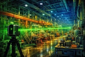
Why is LiDAR Scanning Required in Industrial Environments?
LiDAR scanning provides a rapid, non-contact, and highly accurate methodology for documentation. contactlessThis enables detailed "as-is" recording of industrial facilities without causing any operational downtime or disrupting production processes. Since equipment, piping networks, and conveyor systems require no physical contact, measurements are conducted under maximum operational safety conditions.
Expansive areas are rapidly scanned to generate comprehensive data models of production lines, tank farms, storage racks, and steel structures. as-built The acquired data verifies the accuracy of the "as-built" installation, precisely identifying discrepancies between actual field conditions and initial technical documentation.
Reliable Measurement Solutions for Complex Installations
Industrial plants typically feature hard-to-reach areas filled with intricate piping networks, cable trays, and highly complex equipment layouts. LiDAR scanning mitigates the operational risks associated with conventional surveying methods, capturing these configurations completely and accurately.
Modeling these restricted-access areas with millimeter-level precision significantly minimizes the necessity for repeated site visits for revisions or subsequent adjustments. Consolidating all spatial measurements into a single, unified, and reliable dataset establishes a robust foundation for any engineering project.

Ela GÜRNAL
Geodesy Engineer